
The contractor will carry out most of the £19m-worth of site preparation work on the project.
Earthworks will include the drilling and grouting of mine workings along with the casting of covering slabs for old mineshafts, re-profiling of the ground to allow for new road networks, buildings, foul and surface water drainage, service diversions and retaining structures.
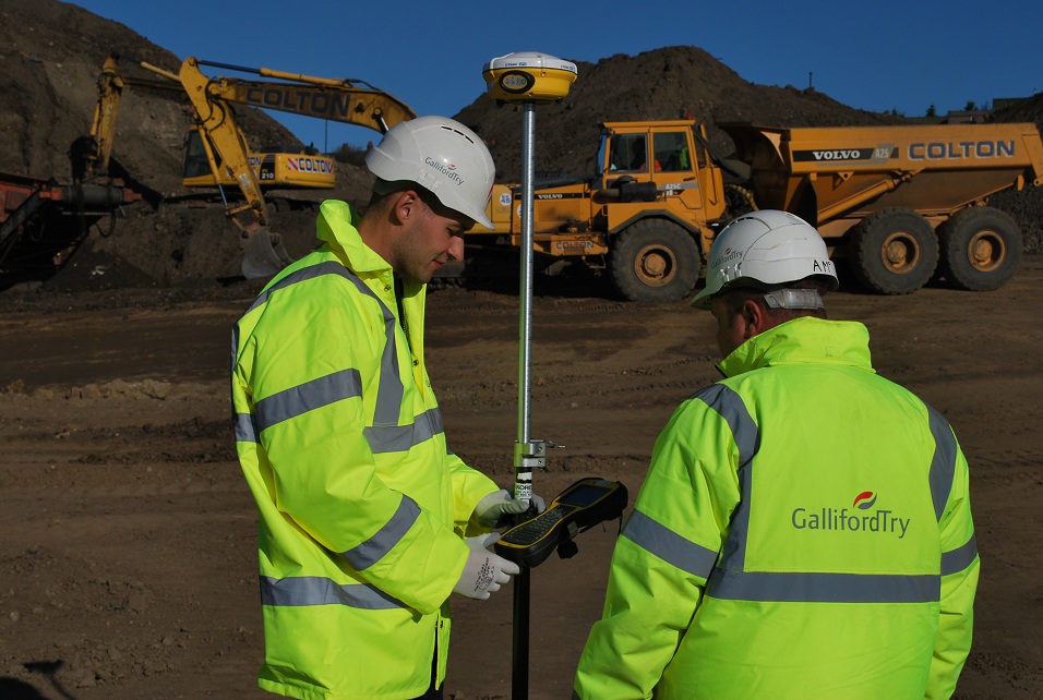
Two site engineers, Andrew Carruthers and Andy McBride, are monitoring the movements of material around the site to ensure that the material cut is suitable as fill. This includes tracking of all material – some 200,000m3 of cut and fill – from point of excavation through stockpile and processing to point of deposition.
The two engineers are also responsible for co-ordinating all services laid onsite for as-built surveys and setting up control for the drainage contractors.
The Galliford Try engineers decided to manage this process by hiring a GPS and data logger system from surveying and safety equipment specialists PQS Survey.
However the lack of speed and reliability of the initial GPS system, along with the limited capabilities of the on-board software, meant an alternative manufacturer’s solution had to be found.
“This type of scheme demands software that’s relevant to the type of site work we’re carrying out on a daily basis,” explains Carruthers.
“The first system we tried simply wasn’t the right tool for the job so PQS Survey introduced us to Trimble and their UK distributor, Korec.”

Galliford Try is now using the Trimble SPS882 GPS and TSC3 logger with SCS900 Site Controller software on board. It includes the ability to calculate the volumes of stockpiles instantaneously along with the ability to use the different DXF drawings provided by the client to set out from.
Day to day tasks for the engineers include liaising with testers and giving them positions to test both cut and fill areas, monitoring of cut and fill movements and surveying areas at the end of the day. The cut and fill areas are then added to a weekly site layout drawing as a record of the movements and the individual cut/fill surfaces compared to the latest topographical survey of the site to obtain a volume and an up to date profile of the site.
With an up to date survey, the engineers can then compare this to the design to produce a cut/fill drawing of the site showing the areas that require the most work. Importantly, they are able to check levels immediately on site rather than having to return to the office to compare levels and positions on CAD.
Carruthers says the use of the Trimble Site Positioning System has increased the accuracy of the volumes, and the speed with which he has been able to set out positions for the testers and survey stockpiles around the site.
“A good example of how the system enables us to save time for volume calculations comes with surveying a stockpile,” explains Carruthers. “Previously we had to get a survey of the top area of a stockpile as well as the base, average the surface area of the top and base, get the differences between these averages and then multiply that difference by the average levels at the top and base to get the volume.
“This is a tedious task and one where the accuracy could always be questioned. We were doing about 6 stockpiles a week and each one would take at least an hour. Using the Trimble Site Positioning System, this task now takes just five minutes.”
As a result of being more productive in the field, Carruthers has been able to spend more time analysing the data back at the office and quickly pick up on any unreliable points.
Got a story? Email news@theconstructionindex.co.uk